Indonesia’s drone laws are pretty relaxed and sensible, so Bali drone photography opens up a world of possibilities.
This is the perfect way to take pictures of Bali’s cliffs, waterfalls, rice terraces, volcanoes, and other natural scenery. The locals are relaxed and don’t mind it at all as long as you’re considerate.
Try to be respectful, of course, and don’t fly inside temples, near airports, or around crowds. As long as you follow these basic rules, you can take some top-notch Bali drone pics and videos.
Nusa Penida drone photos can be especially amazing because of famous places like Broken Beach, Diamond Beach, and the Kelingking T-Rex cliff.
Check out some of these aerial Bali images I’ve taken over the last few years! You can read more about my camera gear here.
52 Beautiful Drone Pictures Of Bali & Nusa Penida

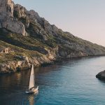
Nusa Penida’s incredible cliffs are perfect for Bali drone photography.

The Ulun Danu Tamblingan temple sits next to Lake Tamblingan in north Bali. It’s one of the best ‘untouched’ temples in Bali.

Beautiful Banah cliffs. One of my favorite views of the Penida coastline.

Morning fog in Kintamani village. The mist always creeps in like this during the mornings in Kintamani.

Canoes on the shore of Lake Tamblingan, near Munduk.

A fisherman in his canoe on Lake Tamblingan.

Yellow rice fields ready for harvest in Sidemen village, east Bali.

Mount Agung as seen from a fishing boat at Amed.

Newly planted green rice terraces in north Bali.

A rainbow at Sekumpul Waterfall. It’s easy to see rainbows at this spot if you visit in July or August.

Another shot of Sekumpul Waterfall from a distance shows the jungle surroundings. This is one of the biggest waterfalls in Bali.

The Belimbing rice terraces in west/central Bali. See the farmer in the bottom left?

A view of Kintamani and the Batur caldera. In the distance, you can see Mount Rinjani on Lombok.

Lake Batur and Mount Abang.

The main volcanic crater at Mount Batur. If you look closely you can see the trekking switchbacks on the right, and small shelters at the top.
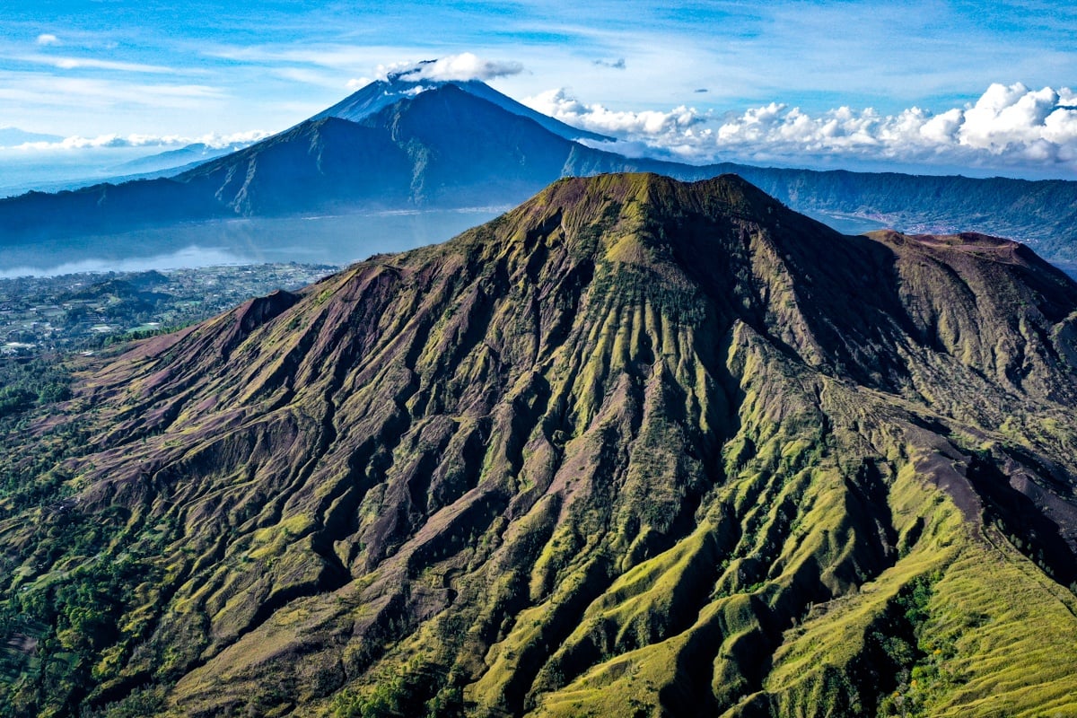
Mount Batur as seen from above, with Mount Agung visible in the background.

An up-close view of the crater rim at Mount Batur.

Mount Batur looks very steep from this angle, but the hike is not too bad.

The wonderful patchwork of the Kintamani crop fields. The best time to photograph these is in the morning.

Classic sunrise view at Mount Batur.

A morning view of Mount Batur from the Kintamani villages.
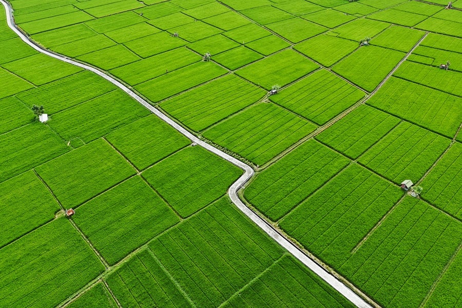
A jogging track in a patchwork of green rice fields we found near Sanur and Denpasar.

Sunset at Mount Batur. Most people come here for sunrise, but the sunset is great too.

Sayan Point is a nice viewpoint near Ubud where you can see rice terraces on the Ayung river bend.

Fishing boats lined up on Amed Beach, in northeast Bali.

An aerial view of Rock n Reef Hotel Uluwatu, which is located right on top of Pemutih Beach.

Jemeluk Bay in Amed, with Mount Agung in the background.

A dramatic view of Sekartaji Cliff Point in Nusa Penida.

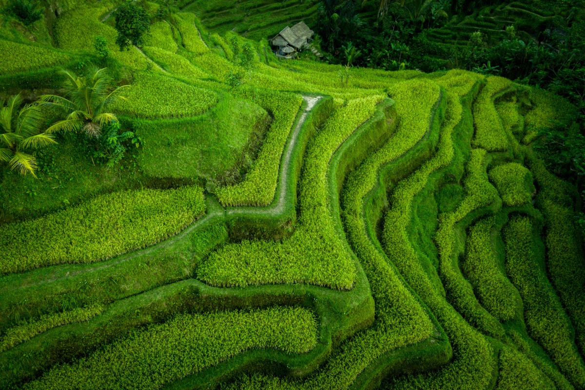
The Tegalalang rice paddies are at peak color. These are Bali’s most famous rice terraces.

More rice terraces near Tegalalang. Aren’t they easy on the eyes? They’re just relaxing to look at.

Rocky coast at the end of Thomas Beach

The famous cliff pagoda at Uluwatu Temple

The steep cliffs of Uluwatu Temple

One of the most bizarre wonders of the Nusa Penida coastline: is Broken Beach! This is a giant circular bay.

A close-up shot of Broken Beach Nusa Penida.

A view of the Sekartaji cliffs from above.

Rocky cliffs of Nusa Penida are seen near Tembeling Beach.

An alternate viewpoint for Kelingking Beach with no crowds! You can find it if you keep walking along the cliffs.

Hills and palms near Atuh Beach.

The giant cliffs of the Kelingking T-Rex.

Diamond Beach is one of the best beaches in Nusa Penida.

The Banah rock is a doughnut-shaped rock near Banah Cliff Point in Nusa Penida.

Another drone shot of Banah Cliff Point.

Snorkeling boats anchored at Crystal Bay.

Endless green carpet of the Jatiluwih rice terraces.

Korawa Beach is a small hidden beach on Penida’s west coast.

The Teletubby Hills in Nusa Penida got that name from their resemblance to the hills in the kids’ show.

Gitgit twin waterfall from above.

A small island off the coast of Penida.

Batu Siha Beach is a hidden beach on Penida that you can only reach with some serious trekking.
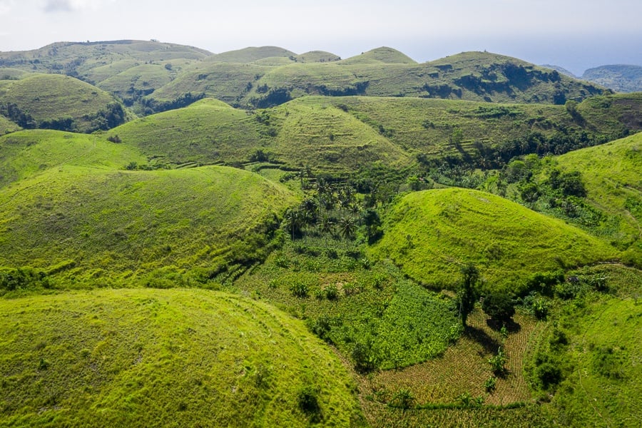
Another aerial view of the Teletubby Hills in Nusa Penida.

Where To Stay